.svg)

The Archangel's Way (Dartmoor)
Southwest England


.svg)
The Archangel's Way (Dartmoor), 30-38 miles, 3-4 days
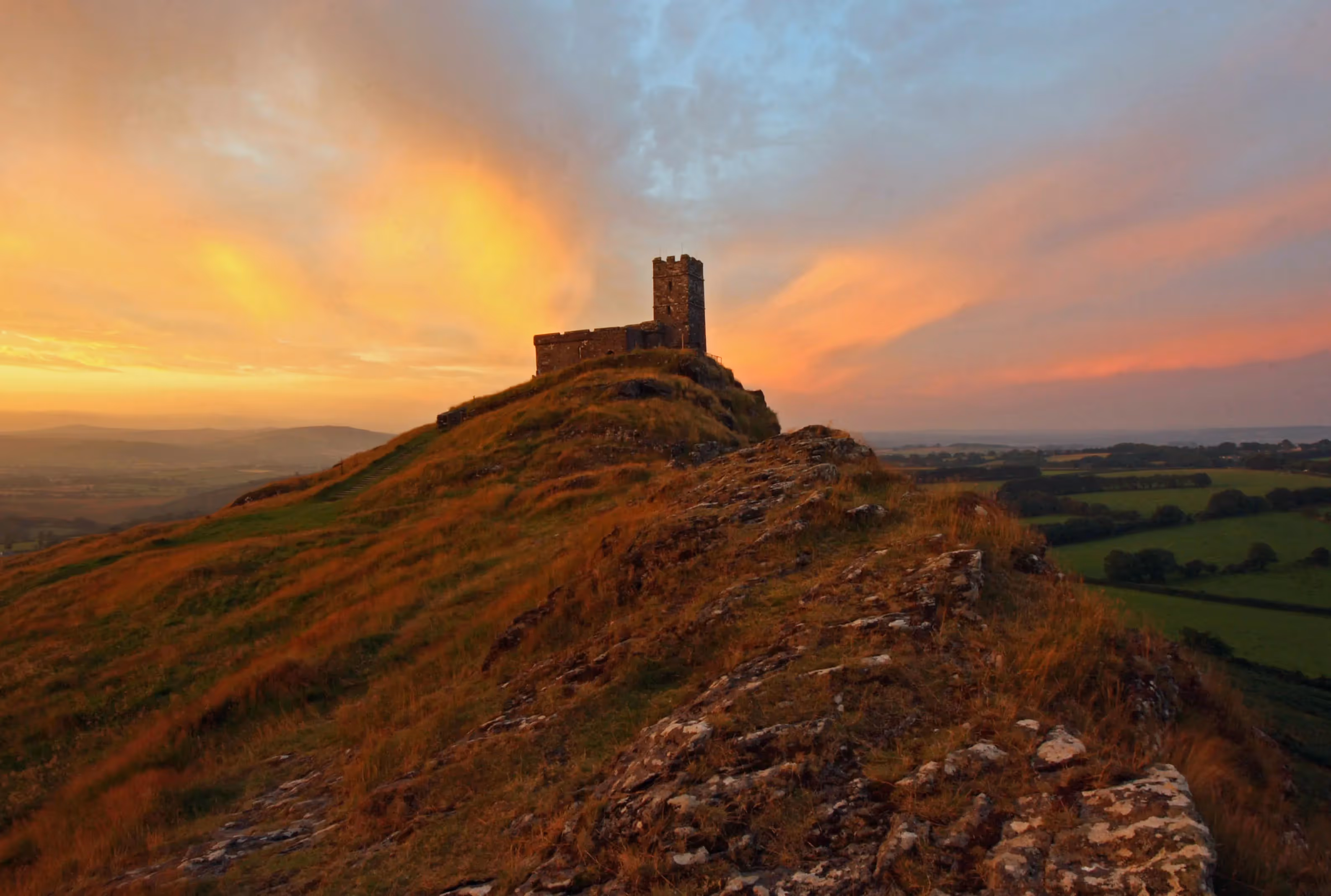
The Archangel’s Way runs for 30-38 miles around the north of Dartmoor. The route begins at the iconic 12th-century church of St Michael de Rupe which stands high on Brent Tor, and ends at St Michael the Archangel in the market town of Chagford. Throughout your journey you will see how nature has run its course, with deep gorges and valleys, waterfalls and rivers, and dramatic tors such as Brat Tor and Black-a-Tor taking centre stage.
Humanity has left its mark on this ancient land. Natural materials such as granite have helped our ancestors to construct buildings, infrastructure and sites of worship. Remote villages, old railway tracks, viaducts and quarries speak of the way communities have survived and adapted in this unique and challenging Dartmoor landscape.
Along the way you will encounter several stone formations at Scorhill, Cosdon and Belstone. The Nine Maidens stone circle at Belstone allegedly represents women who were turned to stone for dancing on the Sabbath. At noon the church bells bring them to life and they begin to dance! The stones were placed in the Bronze Age and form the outer wall of a long-vanished burial chamber (not sure they had the Sabbath in Bronze Age but who cares!).
Our slightly more recent ancestors built some of the most beautiful and impressive churches in Devon. In four churches along The Archangel’s Way you will find at least one wooden roof boss depicting three hares in triangular formation. The motif is an ancient archetype and has leapt across a diverse range of religions, cultures and nations.
Enjoy these and many more experiences as you follow in the footsteps of pilgrims past and present, retreat from everyday life, strengthen your connection with your self and revel in the wild expanse of north Dartmoor.
Ordnance Survey Online Maps:
Stage 1: Brentor to Lydford
Stage 2: Lydford to Sourton (low route)
Stage 2A: Lydford to Sourton (moor route)
Stage 3: Sourton to Belstone (low route)
Stage 3A: Sourton to Belstone (moor route)
Stage 4: Belstone to Throwleigh
Stage 4A: Belstone to Throwleigh (via Cosdon Stone Rows)
Stage 5: Throwleigh to Chagford
Stage 5A: Throwleigh to Chagford (via Scorhill and Kes Tor)
Route highlights

.svg)


.webp)
.webp)
.webp)

Location

Nearby Places
Nearby Sanctuaries
.avif)
.svg)
Discover holy places, and bring your own beliefs.
Pilgrimage by foot is connected with places and landscape, and how those places make you feel. Read about holy places.
At the British Pilgrimage Trust, we believe a pilgrimage should be made on an individual’s own terms. We are founded on the principle that we can all bring our own beliefs to the journey, accessible and welcoming to all.


.svg)
Comments
0 Comments
Login or register to join the conversation.
Tom Jones
Lorem ipsum dolor sit amet, consectetur adipiscing elit. Suspendisse varius enim in eros elementum tristique. Duis cursus, mi quis viverra ornare, eros dolor interdum nulla, ut commodo diam libero vitae erat. Aenean faucibus nibh et justo cursus id rutrum lorem imperdiet. Nunc ut sem vitae risus tristique posuere.